Apps Using WhirlyGlobe-Maply
A toolkit is only as good as the apps that use it. Here are some of our favorites. If you’d like to be included, just send an image, a short description and a link.

ADSB View
ADS-B View is a NextGen airspace app that provides graphical weather, traffic and text data to the aircraft pilot/crew.
AeroTab EFB
AeroTab EFB is an Electronic Flight Bag app specialising in the Russian and the CIS Region.
ClimEarth
CLIMEARTH is a mobile application designed and produced by CMCC, the Euro-Mediterranean Center on climate Change to show important climate related data sets.AeroApp EFB
AeroApp is a free DoD-Owned Electronic Flight Bag by Hilton Software.
Dark Sky (iOS)
Dark Sky is one of the Apple app store's favorite weather apps. Not only will it tell when it's going to rain it'll show you beautiful animated weather and temperature data.
Dark Sky (Android)
Dark Sky is also available for Android devices.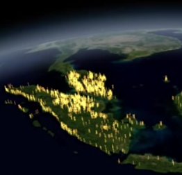
Deforestation Visualization
A visualization by José Manuel Navarro made for Vizzuality. It shows deforestation in Indonesia over time. Colored vectors are used to denote intensity.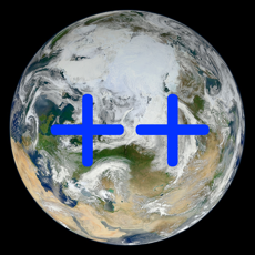
Earth++
A 3D climate and event viewer
Earthquake PRO
A simple and colorful earthquake app that focuses in the synthesis of earthquakes provided by national and international data agencies for an easy and updated vision.
Economist - World in Figures
Get access to over 100 country ranking indice covering everything from agriculture, business and education to health, population and transport
eLLaWalk
eLLaWalk is part of the promotion for the new eLLa fragrance from Victorinox. This Android app lets you see your organized walks on your device.
Epicenter
An interactive, animated app plotting the latest 30 days of USGS earthquake data.
Ergo360
The Ergo 360 app calculates an aircraft’s fuel and oxygen consumption at a given altitude and plots their ranges as different colored rings on an interactive map.
Fielda Freedom
Field Services Management
Flag Ceremony
This app displays flags of the world on a globe along with national anthems and other information.
Flight Assistant
Flight Assistant is an aviation moving map GPS application. Displays a wide variety of aviation data in detail.
Flightwise Flight Planner
An aviation app designed for pilots that can create and file flight plans, view aviation charts and weather and lookup airport information.
Flightwise Flight Tracker
This is a flight tracker for individual commercial flights.
FlyQ EFB
One of the more popular aviation planning and visualization apps. Made by Seattle Avionics, this is one of the most complex WhirlyGlobe-Maply apps.
FlyTab
FlyTab Cockpit is an avionics test environment and simulator for the flyTab avionics platform.
Forecast Now
Your local weather forecast.
Gaia GPS
Gaia GPS was featured in Apple's Your Verse stories, Gaia GPS helps people explore remote places, and stay safer in the woods.
GlobalCast
Your local weather forecast
Global Schooner
Take an interactive journey across the globe with Prairie Schooner, complete with exclusive content and more than 300 profiles of authors from around the world.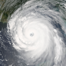
Global Storms
Worldwide Weather & Climate
Find the Fun
A platform for map-based guidebook apps. The iOS version uses WhirlyGlobe-Maply.
FLIO
Get instant updates for your flights: be the first to know about any delays, gate changes, boarding times and baggage claim belts with FLIO’s real-time flight status system.
iBobber
The iBobber app from Reelsonar interfaces to their fish finding hardware. It also shows a globe with active users.
iBobber
The iBobber app from Reelsonar is also available on Android.
InterAtlas
Inter Atlas has the distinction of being the first WhirlyGlobe app. It's a neat little geography tool hooked up to wikipedia.
LiveFlight
LiveFlight is a flight tracker for the mobile flight simulator, Infinite Flight. Explore flights on a 3D globe or interact with highly-detailed airport ground charts.
Mapbox Earth
Mapbox Earth is a neat little browser for Mapbox's excellent satellite imagery data sets.
Met Office Weather (iOS)
The official weather app from the UK's weather service. It provides a variety of warnings, precipiation display, and other information.
Met Office Weather (Android)
The official Met Office app is also available for Android.
Miizee
Use Miizee to broadcast HD quality live events on-the-go from any location to any screen using only your Facebook account to connect with the world.
MX Tides
Harmonic tide clock and tide predictor
National Geographic World Atlas
A very popular reference app on iOS, version 4.0 uses WhirlyGlobe to great effect.
NATS Airspace Explorer
Airspace Explorer is a flight tracking and airspace education app developed by the National Air Traffic Control System of the UK.
Oceans Now
The latest ocean conditions
Offline Topo Maps
Offline Topo Maps is a simpler version of Gaia GPS.
OrbTrack
Allows you to discover where many of the objects above earth are at any time and place.
Places Been
Keep track of the cities you visited on your trips and review your statistics!
Planet.ly
Planet.ly is a fun news aggregator that shows you what's happening around the globe.
Pray 2x714
Join with others around the world in prayer as each time zone prays together at 7:14.
Radio Globe
Ever wonder what radio stations people are listening to around the world? Well this app let's you explore and discover thousands of radio stations on Earth.
Saildrone Forecast
HD Wind, Rain, Snow & Tides
Santa's Big Helper
Santa's Big Helper is a cute holiday app for tracking Santa Claus as he journeys around the globe.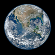
Satellite Chasers
Satellite Chasers is a competitive game where satellites are animated over the globe as spheres in real time.
Skipper
Skipper is mobile charts done right. A seamless chart-plotter, with data synced across all of your devices, and backed up to the cloud.
SkyDreamSoft SDVFR
Cette application est destinée aux pilotes d'avions légers, d'ULM et aux utilisateurs de simulateurs sur ordinateur. Elle couvre la France métropolitaine et partiellement l'outre-mer.
SmartPlates & Charts
An aviation display app for FAA sectionals, charts, and other data.
Sport At Maps
This app displays historical sporting information around the world.
Stratalogica
Stratalogica is a big, gorgeous interactive globe for students of all ages. You can browse existing content or make your own with an on-globe editor.
Stratus Insight EFB
An electronic flight bag (EFB) app with TAWS, EDR, and terrain support. Made by Bryan Heitman.
Symantec Protection Center Mobile
The Protection Center Mobile app from Symantex shows global network threats around the world.
Syncrohearts Love Game
A fun and playful game just for two.Tremor Tracker
Tremor Tracker lets you see recent earthquakes around the globe.
wetter.com (iOS)
One of Germany's most popular weather apps. It displays some of the smoothest, most beautiful precipication data available.
wetter.com (Android)
One of Germany's most popular weather apps is also available on Android.
WhirlyViz
WhirlyViz is a data visualization engine for iPad and iPhone. It uses Javascript modules to let users play with big, complex data sets.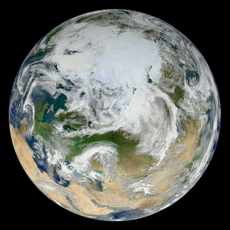
World Now
Satellite views of Earth
Xweather - Extreme Weather
Xweather displays extreme weather related events on a globe.